import os

import contextily as cx
import geopandas as gpd
import matplotlib.pyplot as plt
from matplotlib.axes import AxesTown Boundaries of Bicol Region
This notebook prepares the study area’s geographical data. It downloads Philippine administrative boundaries, filters them to isolate the Bicol Region, and cleans the town names before saving the data.
0 Preliminaries
BASE_PATH = os.path.join(".", "outputs")

if not os.path.exists(BASE_PATH):
    os.makedirs(BASE_PATH)
1 Load data from Humanitarian Data Exchange
filename = (
    "https://data.humdata.org/dataset/caf116df-f984-4deb-85ca-41b349d3f313/resource/"
    "314cbaea-c7a0-4ce9-a4ea-e5af2a788ac1/download/phl_adm_psa_namria_20231106_gdb.gdb.zip"
)

gdf_bounds = gpd.read_file(filename, layer="phl_admbnda_adm3_psa_namria_20231106")
gdf_bounds.head()
/home/ainz/Code/transport-network-analysis/.venv/lib64/python3.13/site-packages/pyogrio/raw.py:198: RuntimeWarning: organizePolygons() received a polygon with more than 100 parts. The processing may be really slow. You can skip the processing by setting METHOD=SKIP.
return ogr_read(| ADM3_EN | ADM3_PCODE | ADM2_EN | ADM2_PCODE | ADM1_EN | ADM1_PCODE | ADM0_EN | ADM0_PCODE | date | validOn | validTo | ADM3_REF | ADM3ALT1EN | Shape_Length | Shape_Area | AREA_SQKM | geometry | |
|---|---|---|---|---|---|---|---|---|---|---|---|---|---|---|---|---|---|
| 0 | Adams | PH0102801 | Ilocos Norte | PH01028 | Region I (Ilocos Region) | PH01 | Philippines (the) | PH | 2022-11-09 00:00:00+00:00 | 2023-11-06 00:00:00+00:00 | NaT | None | None | 0.423604 | 0.009506 | 111.143026 | MULTIPOLYGON (((120.96915 18.51012, 120.95867 ... |
| 1 | Bacarra | PH0102802 | Ilocos Norte | PH01028 | Region I (Ilocos Region) | PH01 | Philippines (the) | PH | 2022-11-09 00:00:00+00:00 | 2023-11-06 00:00:00+00:00 | NaT | None | None | 0.309136 | 0.004725 | 55.303195 | MULTIPOLYGON (((120.66821 18.28705, 120.66441 ... |
| 2 | Badoc | PH0102803 | Ilocos Norte | PH01028 | Region I (Ilocos Region) | PH01 | Philippines (the) | PH | 2022-11-09 00:00:00+00:00 | 2023-11-06 00:00:00+00:00 | NaT | None | None | 0.599295 | 0.006880 | 80.683970 | MULTIPOLYGON (((120.47814 17.97717, 120.47816 ... |
| 3 | Bangui | PH0102804 | Ilocos Norte | PH01028 | Region I (Ilocos Region) | PH01 | Philippines (the) | PH | 2022-11-09 00:00:00+00:00 | 2023-11-06 00:00:00+00:00 | NaT | None | None | 0.483066 | 0.009843 | 115.059041 | MULTIPOLYGON (((120.81318 18.53457, 120.81358 ... |
| 4 | City of Batac | PH0102805 | Ilocos Norte | PH01028 | Region I (Ilocos Region) | PH01 | Philippines (the) | PH | 2022-11-09 00:00:00+00:00 | 2023-11-06 00:00:00+00:00 | NaT | None | None | 0.613500 | 0.013493 | 158.123132 | MULTIPOLYGON (((120.61242 18.10947, 120.612 18... |
2 Limit coverage to Bicol Region
gdf_bounds = gdf_bounds[gdf_bounds["ADM1_EN"].str.contains("Bicol")]
gdf_bounds = gdf_bounds.reset_index(drop=True)
_, ax = plt.subplots(figsize=(8, 8))
gdf_bounds.plot(ax=ax, edgecolor="white", facecolor="seagreen", linewidth=0.5)
x_min, y_min, x_max, y_max = gdf_bounds.total_bounds
padding = 0.1
ax.set_xlim(x_min - padding, x_max + padding)
ax.set_ylim(y_min - padding, y_max + padding)
cx.add_basemap(
ax,
crs=gdf_bounds.crs,
source=cx.providers.CartoDB.Positron,
attribution="",
)
ax.set_title("Town Boundaries of Bicol Region")
ax.set_axis_off()
plt.tight_layout()
filepath = os.path.join(BASE_PATH, "boundaries.png")
plt.savefig(filepath, dpi=300, bbox_inches="tight")
plt.show()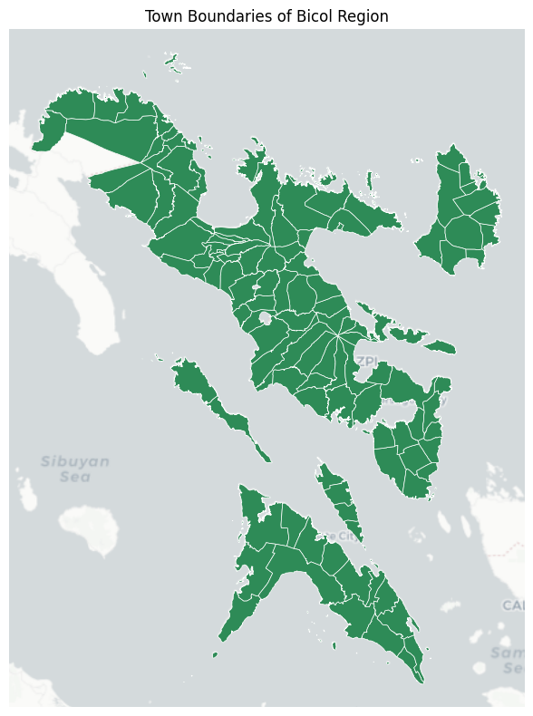
3 Select relevant columns
gdf_bounds = gdf_bounds[["ADM3_EN", "ADM2_EN", "geometry"]]
gdf_bounds = gdf_bounds.rename(columns={"ADM3_EN": "town", "ADM2_EN": "province"})
gdf_bounds.head()| town | province | geometry | |
|---|---|---|---|
| 0 | Bacacay | Albay | MULTIPOLYGON (((123.84193 13.3341, 123.84204 1... |
| 1 | Camalig | Albay | MULTIPOLYGON (((123.6559 13.06131, 123.65536 1... |
| 2 | Daraga (Locsin) | Albay | MULTIPOLYGON (((123.71487 13.03995, 123.71474 ... |
| 3 | Guinobatan | Albay | MULTIPOLYGON (((123.68355 13.25321, 123.67729 ... |
| 4 | Jovellar | Albay | MULTIPOLYGON (((123.6559 13.06131, 123.65568 1... |
4 Format town names
gdf_bounds["town"] = gdf_bounds["town"].str.replace(r"\s*\(.*\)", "", regex=True)

mask = gdf_bounds["town"].str.startswith("City of ", na=False)
gdf_bounds.loc[mask, "town"] = gdf_bounds["town"].str.removeprefix("City of ")
gdf_bounds.loc[mask, "town"] = gdf_bounds["town"] + " City"

gdf_bounds["town"].unique()
array(['Bacacay', 'Camalig', 'Daraga', 'Guinobatan', 'Jovellar',
'Legazpi City', 'Libon', 'Ligao City', 'Malilipot', 'Malinao',
'Manito', 'Oas', 'Pio Duran', 'Polangui', 'Rapu-Rapu',
'Santo Domingo', 'Tabaco City', 'Tiwi', 'Basud', 'Capalonga',
'Daet', 'San Lorenzo Ruiz', 'Jose Panganiban', 'Labo', 'Mercedes',
'Paracale', 'San Vicente', 'Santa Elena', 'Talisay', 'Vinzons',
'Baao', 'Balatan', 'Bato', 'Bombon', 'Buhi', 'Bula', 'Cabusao',
'Calabanga', 'Camaligan', 'Canaman', 'Caramoan', 'Del Gallego',
'Gainza', 'Garchitorena', 'Goa', 'Iriga City', 'Lagonoy',
'Libmanan', 'Lupi', 'Magarao', 'Milaor', 'Minalabac', 'Nabua',
'Naga City', 'Ocampo', 'Pamplona', 'Pasacao', 'Pili',
'Presentacion', 'Ragay', 'Sagñay', 'San Fernando', 'San Jose',
'Sipocot', 'Siruma', 'Tigaon', 'Tinambac', 'Bagamanoc', 'Baras',
'Caramoran', 'Gigmoto', 'Pandan', 'Panganiban', 'San Andres',
'San Miguel', 'Viga', 'Virac', 'Aroroy', 'Baleno', 'Balud',
'Batuan', 'Cataingan', 'Cawayan', 'Claveria', 'Dimasalang',
'Esperanza', 'Mandaon', 'Masbate City', 'Milagros', 'Mobo',
'Monreal', 'Palanas', 'Pio V. Corpus', 'Placer', 'San Jacinto',
'San Pascual', 'Uson', 'Barcelona', 'Bulan', 'Bulusan',
'Casiguran', 'Castilla', 'Donsol', 'Gubat', 'Irosin', 'Juban',
'Magallanes', 'Matnog', 'Pilar', 'Prieto Diaz', 'Santa Magdalena',
'Sorsogon City'], dtype=object)5 Save data
filepath = os.path.join(BASE_PATH, "boundaries.gpkg")
gdf_bounds.to_file(filepath, driver="GPKG")